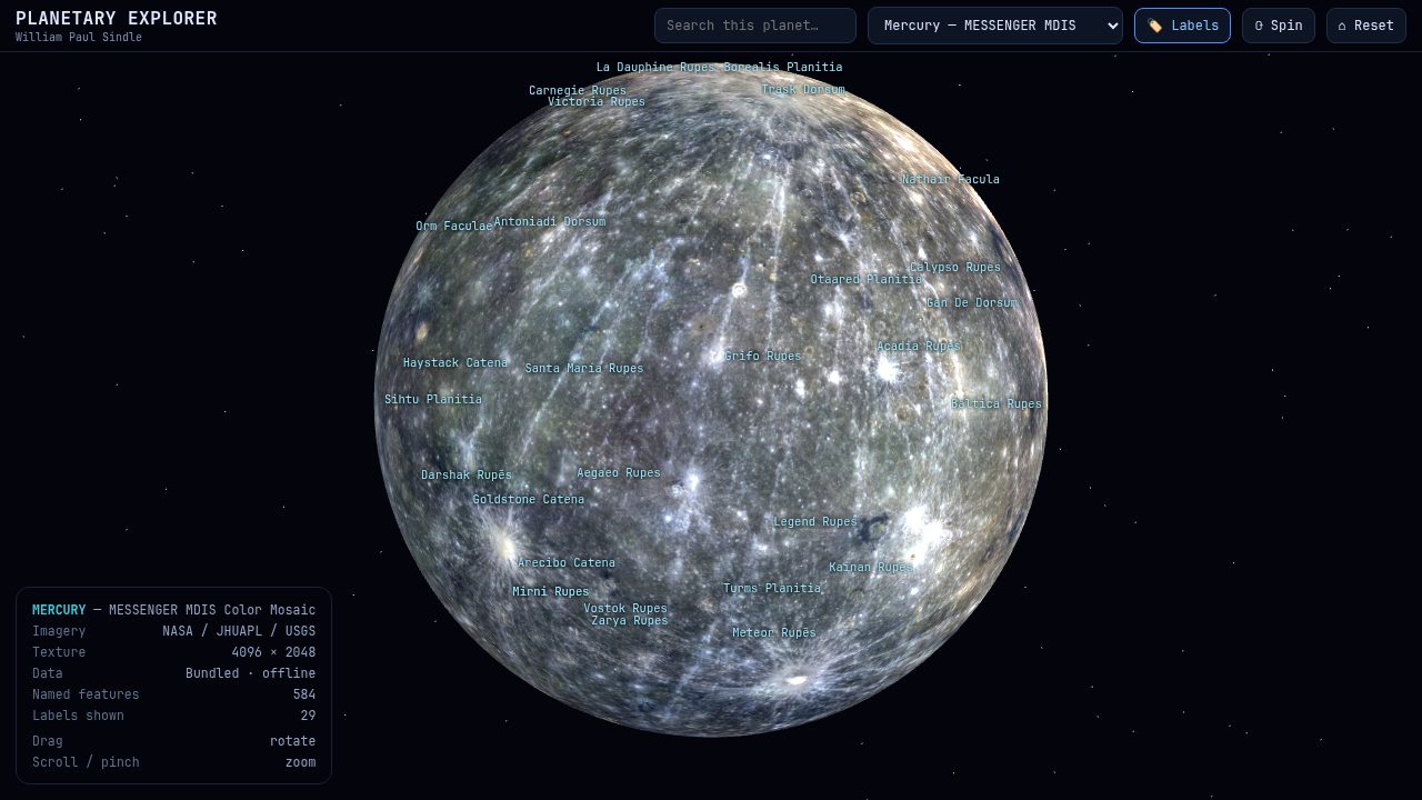
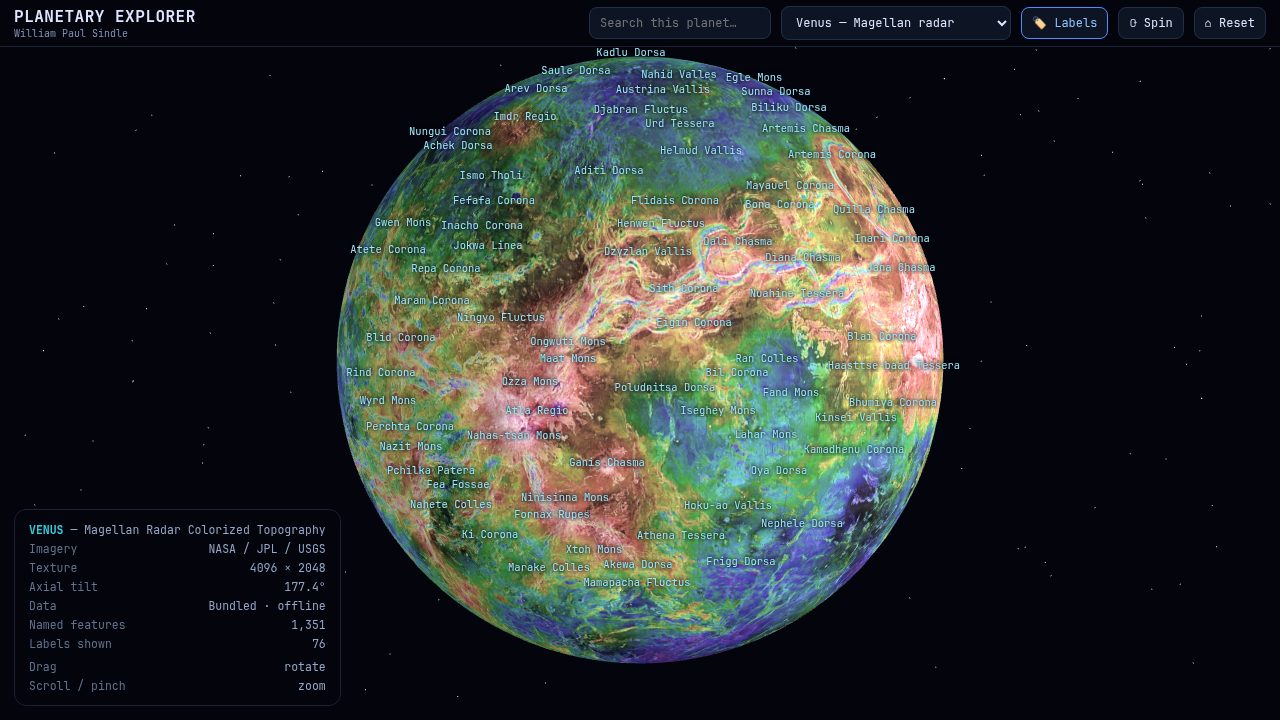
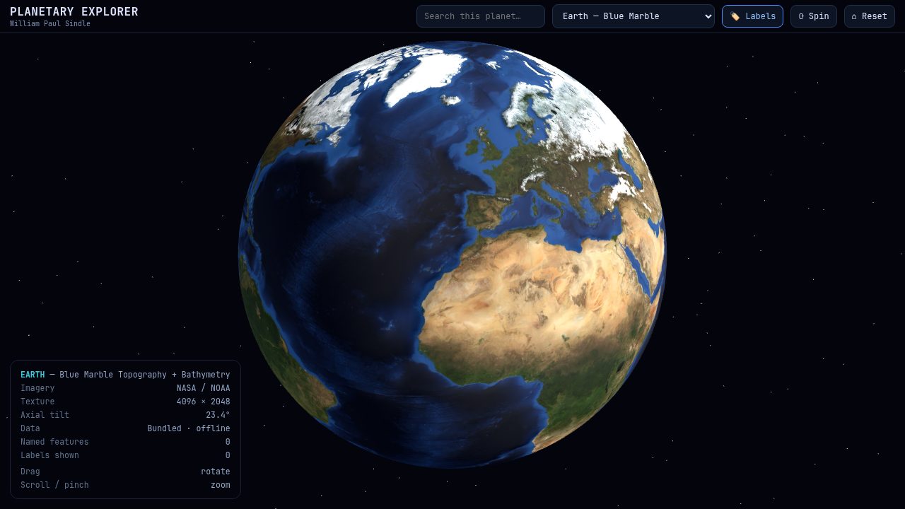
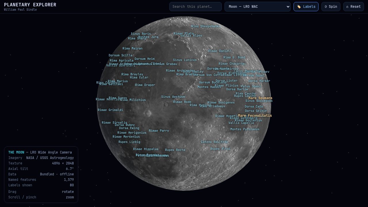
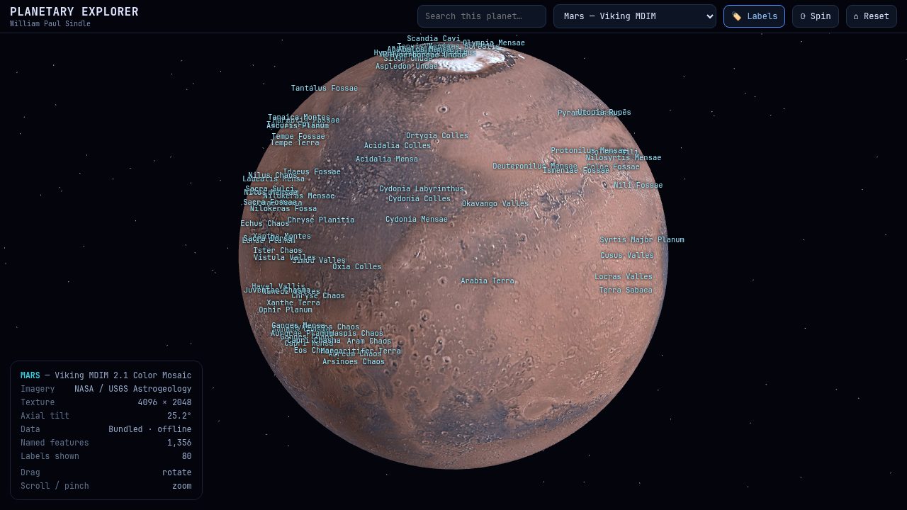
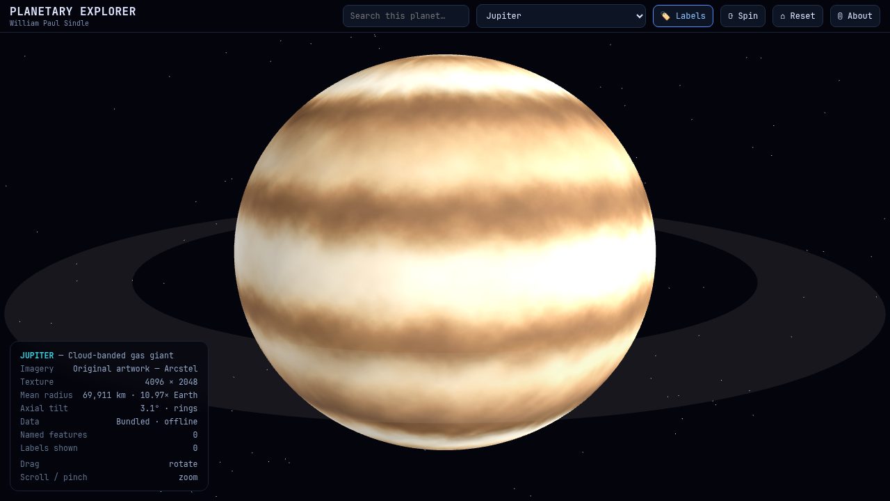
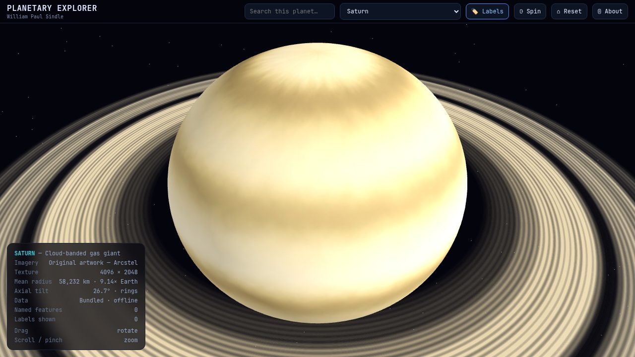
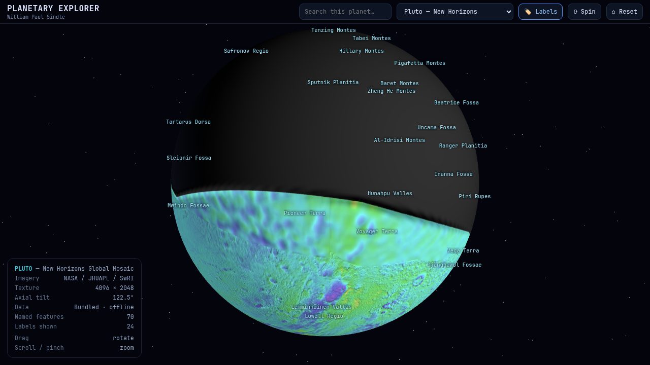
20 worldsMercury to Neptune, plus Pluto, Charon, the Moon, Phobos, Deimos, Ceres, Vesta, Europa, Ganymede, Titan, Enceladus and Bennu — each with its own globe, data panel and named features.
Live orbit mapA true Solar-System map with planets on their real orbits for any date from 1800 to 2050. Play the clock, jump to presets, and follow named comets including Halley, Hale-Bopp, NEOWISE and the interstellar visitors ʻOumuamua, Borisov and 3I/ATLAS.
244,625 place namesEarth's full gazetteer — countries, states, capitals, cities and physical features — revealed in tiers as you zoom. Filter by category or search any name and fly to it.
Tiled deep detailEarth gains a high-resolution layer (~1.6 km per pixel) blended in as you approach, held in memory one tile at a time.
Street-level EarthSeven metro areas open as flat, pannable street maps at ~1.2 m per pixel, from public-domain aerial imagery — close enough to pick out individual buildings. Crisp OpenStreetMap road lines stay sharp at any zoom.
Earth layersOne 🖼 Layers panel gathers the real data overlays — a NASA total-column ozone map with a Dobson-Unit legend, and geology (plate boundaries, major faults and 1,571 volcanoes), plus a label backdrop for readability. All public-domain data, all offline.
Weather-teaching layerAn optional classroom schematic of the semi-permanent highs and lows — idealized isobars and circulating surface winds, with the Coriolis sense made explicit. Clearly labelled a teaching model, not live data.
ExoplanetsOver 100 notable worlds from other star systems, curated from the NASA Exoplanet Archive — Proxima b, the TRAPPIST-1 family, the hottest and puffiest planets and the historic firsts. Browse them in the Codex and search by planet or host-star name.
Smooth, natural zoomZoom follows altitude, so the ground tracks your finger from whole planet down to a city. Scroll, pinch, or drag the slider; labels resolve continent → country → state → city.
Astrology modeA complete birth-chart engine — Ascendant, Midheaven and houses in Placidus, whole sign, equal or Porphyry, with positions, retrograde states, aspects, an aspect grid and a house table, plus element/modality balance, essential dignities, the lunar nodes and Chiron, aspect patterns, retrograde stations, fixed-star contacts, midpoints, the Arabic parts, transits, progressions and the solar return. A Classic 2D style redraws the wheel in the traditional flat idiom for working astrologers, with a light print theme and a full chart-sheet export.
Every mode, one tapA Modes grid jumps to any view — atlas, solar system, sky tracker, space weather, astrology, Moon, almanac, AR, codex, First light — each with a one-line how-to and its own help — plus a Find-anything search inside Help that jumps straight to any feature.
SynastryCompare two people on a single bi-wheel: both charts, every cross-aspect, an inter-aspect list and a synastry grid.
Moon modeThe Moon's true phase for any date — illumination, age, distance, angular size, next phases, rise/set times and a month of phases at a glance.
Full sky chart41,411 stars (108,000 optional), all 88 constellations with figures and IAU boundaries, and 1,900 deep-sky objects — Messier, Caldwell and bright NGC/IC — plotted and searchable, with a Tonight planner and public-domain photographs of famous objects.
Teacher modeA classroom layer: guided lessons at three levels (Earth Science, High School, College), an offline quiz, and printable worksheets. Built for projectors, tablets and no Wi-Fi.
Ambient musicAn optional soft ambient tone, generated for the app and bundled offline — no streaming, no licence, no ads. Toggle it from the bar.
Made for every screenA layout that adapts from phone to tablet and landscape — the toolbar collapses to a Menu button on small phones — with keyboard focus, screen-reader labels and reduced-motion support.
Guided onboardingFirst launch opens with a thank-you and a choice: a very thorough Full tour of every control, a Quick tour, or Skip — reopenable any time from About.
Three interface skinsObservatory brass, teal Midnight, or amber Ember — switch the whole interface mood in Settings. Same layout, same data, zero clutter.
Jupiter & SaturnJupiter's four Galilean moons positioned from their real orbital periods — with transits, occultations and shadow transits marked — and Saturn's ring opening angle with Titan, all live as you change the date.
Observing listsStar your favourites, or browse built-in Messier, Caldwell and binocular-best lists with each object's live altitude and bearing. Create your own named lists, reorder them, and import or export as text.
Telescope controlConnect to an ASCOM Alpaca mount on your own network and GoTo or Sync the selected object, with abort and park. No account, no cloud.
AR overlayPoint your camera at the sky and the chart is drawn over it — stars, constellations, planets and deep-sky objects, aligned to your device. Falls back to drag-to-look without a compass.
Setup & Help built inA step-by-step guide for connecting a telescope and setting up AR, with on-screen alignment controls if your device's compass or field of view needs a nudge.
First LightA one-tap pre-session checklist: darkness window, Moon, what is up now with bearings, telescope/AR readiness, and the month's events.
Share & exportSend tonight's plan or any observing list to a friend, the clipboard, or a text file — with coordinates, magnitudes and bearings.
41,411 stars (108,000 optional)A deep naked-eye and binocular star catalogue to magnitude 8, with all 88 constellations, and 1,900 deep-sky objects on top.
Night & sepia modesTap once to dim the whole interface to red for dark-adapted observing, or switch to a warm sepia tone for comfortable daytime and low-blue reading.
Natural, precise touchDrag follows your finger at every scale — from whole planet down to a single city — with sensitivity that eases off as you zoom in, so the ground never whips past.
AlmanacA month calendar with sunrise, sunset, twilight, moonrise, moonset, day length, daily moon phase, the season dates and the full moon's traditional name.
Sky eventsEach month's eclipses, planet oppositions, conjunctions and greatest elongations, and the meteor showers peaking that month — computed offline.
Solar-flare projectionThe Sun's active regions from public-domain NOAA SWPC data, with our own geometry for flare risk and Earth impact, plus flare history, Kp and the solar wind — all offline.
340+-body codexA historical page for every catalogued body — naming, etymology, discovery and key facts — browsable and searchable, now including notable exoplanets. Worlds with imagery open as 3D globes.
Fully offlineEvery texture, tile and label is bundled in the app. No internet needed, no ads, no accounts, no tracking. (You can optionally let the space-weather view refresh from NOAA.)
Guided welcomeA short first-run tour introduces the worlds, the system bar and the sky tools, so a new explorer is never lost. Reopen it any time from About.
True 360° globesSpin every world freely in any direction — no pole lock — with altitude-aware drag so the ground tracks your finger at any zoom.
Real imageryNASA / USGS spacecraft data and public-domain aerial photography, with original procedurally-generated gas-giant artwork.
Toward realAxial tilts, polar flattening and rings for the gas giants, and adjustable orbit-path styling.
 The live orbit map. Every planet where it really is, for any date from 1800 to 2050 — set a date, press play, watch the system turn. Track named comets, switch the orbit drawing style, or flip to true scale to feel how empty space really is.
 244,625 place names. Earth carries a full gazetteer that reveals itself as you descend — countries, states and provinces, capitals, cities, peaks, seas, lakes, rivers. Filter by category, or search and fly to anywhere.
 Street-level Earth. Open any of seven metro areas as a flat, pannable map at about 1.2 metres per pixel, with crisp OpenStreetMap road lines overlaid so streets stay sharp at any zoom — individual streets and buildings, from public-domain aerial imagery (lines © OpenStreetMap contributors, ODbL).